WWII April 1944 US Army Air Force Special Air Navigation Chart (Contains Air Operational Markings)*


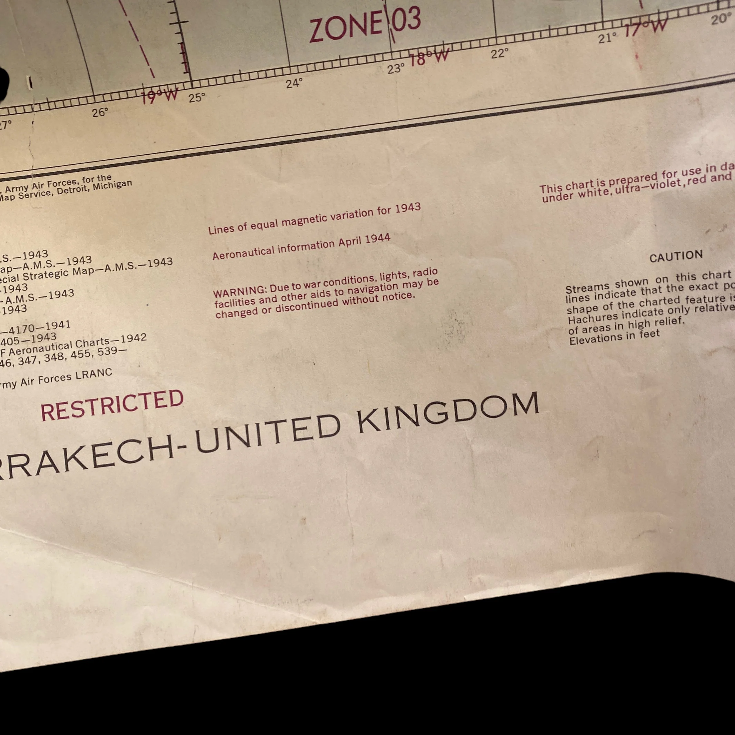


WWII April 1944 US Army Air Force Special Air Navigation Chart (Contains Air Operational Markings)*
Comes with C.O.A.
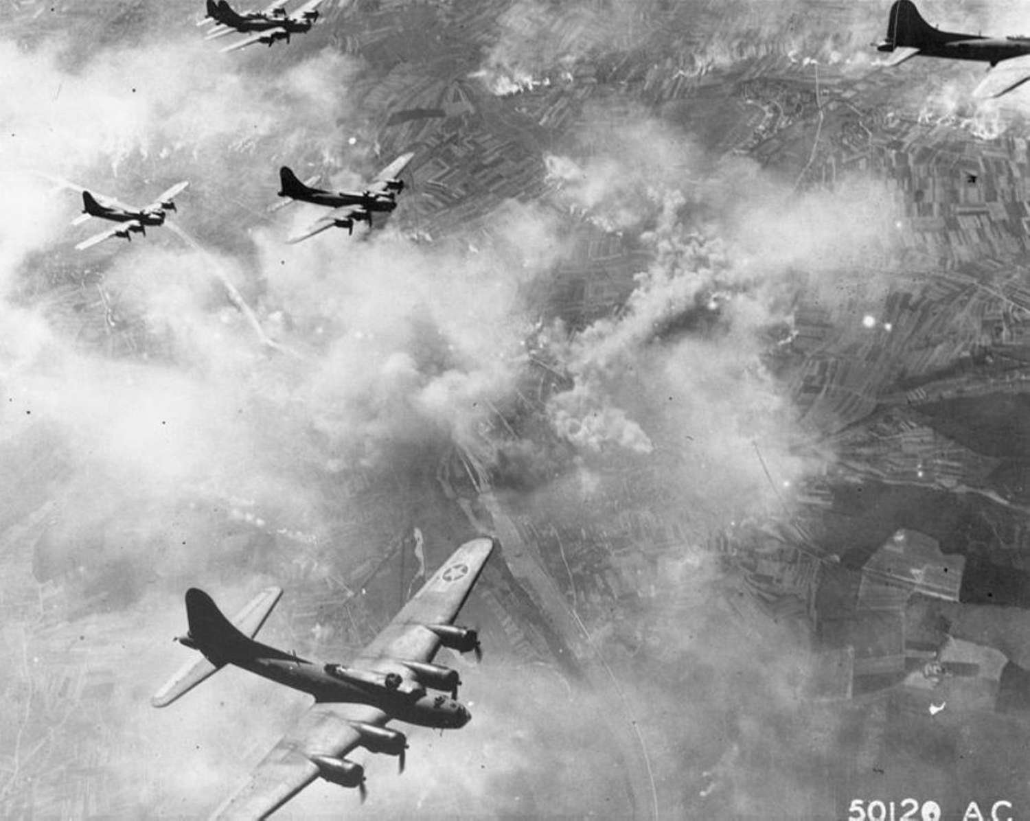
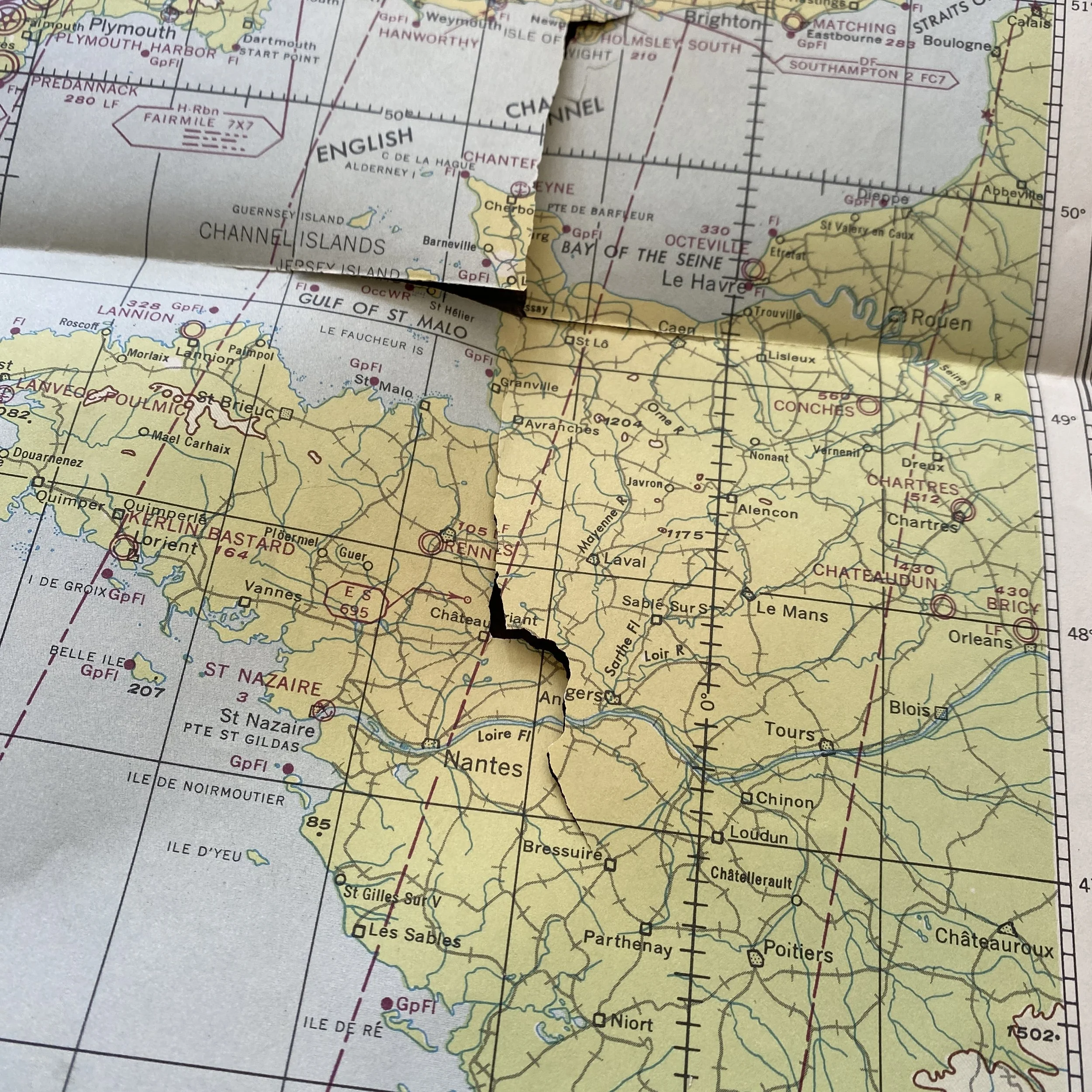
This incredible museum grade World War II, US Army Air Force is special air navigation chart is marked RESTRICTED. Restricted markings were done so when maps were used within that specific area of operation and contain sensitive information. Dated April 201944. This map is produced two months prior to the LADD invasion on the Normandy coast of France. This map shows a very large section of the European Theater, including England and France. This map does have operational navigational markings which makes it even more special. Please note that this map is very delicate and is torn in multiple parts. The paper is very delicate and should be handled with the upmost care.
During World War II, the U.S. Army Air Forces (USAAF) relied heavily on navigation charts to ensure the safe and accurate navigation of their aircraft. One of the most important charts used by the USAAF was the Special Air Navigation Chart (SANC), which provided detailed information on terrain features, navigation aids, and other critical data needed for safe navigation. This essay will explore the history and importance of the SANC, as well as its use in the European Theater of Operations during World War II.
The SANC was first introduced in the early 1940s as a response to the increasing complexity of air navigation. Prior to the development of the SANC, navigators relied on standard aeronautical charts, which were designed primarily for use in commercial aviation. While these charts provided some useful information, they were not detailed enough for military operations, which required much greater precision and accuracy. The SANC was specifically designed to meet the needs of military navigators, providing them with the detailed information they needed to navigate safely and effectively.
The SANC was produced by the USAAF's Aeronautical Chart Service, which was responsible for creating and maintaining all of the navigational charts used by the USAAF. The SANC was created using a variety of sources, including aerial photographs, ground surveys, and other intelligence data. The chart was updated regularly to ensure that it remained accurate and up-to-date, with new editions produced as needed.
One of the most important features of the SANC was its detailed information on terrain features. The chart included information on the location and elevation of mountains, valleys, rivers, and other natural features that could affect aircraft navigation. This information was critical for pilots and navigators, who needed to be able to navigate safely through mountainous terrain, avoid obstacles such as power lines and buildings, and make accurate landings on airfields.
In addition to terrain features, the SANC also provided detailed information on navigation aids such as radio beacons, airfields, and other landmarks that could be used to navigate. This information was critical for military aircraft, which often flew in conditions of low visibility or poor weather, making it difficult to navigate using visual references alone. The SANC provided pilots and navigators with the information they needed to navigate accurately, even in these challenging conditions.
The SANC played a crucial role in the European Theater of Operations during World War II. As the USAAF conducted bombing raids and other operations across Europe, navigators relied heavily on the SANC to navigate safely and effectively. The chart was particularly important in areas where the terrain was rugged or unfamiliar, such as in the mountains of Italy or the forests of Germany. In these areas, the SANC provided navigators with the detailed information they needed to navigate accurately, avoid obstacles, and make accurate landings.
The SANC was also used extensively in the planning of operations. Prior to each mission, navigators would study the SANC carefully, identifying potential hazards, determining the best routes to take, and identifying landmarks that could be used for navigation. This careful planning helped to ensure the safety and success of each mission, and the SANC played a critical role in this process.
In conclusion, the Special Air Navigation Chart was an essential tool for the USAAF during World War II. Its detailed information on terrain features, navigation aids, and other critical data helped to ensure the safe and accurate navigation of military aircraft. In the European Theater of Operations, the SANC played a crucial role in the success of USAAF operations, providing navigators with the information they needed to navigate safely and effectively in challenging conditions. Today, the legacy of the SANC lives on in modern navigation charts, which continue to provide pilots and navigators with the detailed information they need to navigate safely and effectively.